Long before it became a beach destination, the Island of Santa Catarina was a frontier outpost. In the 18th century it marked the southern edge of Portuguese domain in the Americas, a contested edge, coveted by the Spanish crown pushing up from the Río de la Plata. Whoever controlled the entrance to the bay controlled the Atlantic route that linked Rio de Janeiro to Colônia do Sacramento (then a Portuguese trading post on the Plata estuary).
Portugal’s answer was to build a system of fortresses. Beginning in the early 1740s, under Brigadier José da Silva Paes, a set of fortifications rose, designed to cross fire over any ship that tried to enter. It is this system that the forts of Florianopolis refer to today.
This guide gathers what is known with confidence about them: why they were built, how they worked together, the day they failed, and how you can visit them today, some by car, most only by water.
Why an island of fishermen gained a military belt
On the political map of the 18th century, Santa Catarina was the southernmost settled point of the Portuguese empire. Below it, the territory was a zone of friction with Spain, and possession of the island served as a resupply base and a staging point for the fleet.
José da Silva Paes arrived in 1739 as the first governor of the captaincy (capitania, a colonial administrative province) and a military engineer by training. His task was to turn a settlement of Azoreans and fishermen into a defensible stronghold. His reading was geographic: the northern bay had a narrow entrance, and cannon well placed on the islands and headlands of that entrance could strike any enemy vessel before it anchored.
Hence the logic of the system. It was not a single large fort but several smaller positions that supported one another. The fire of one covered the blind spot of the next. That is the difference between a wall and a belt, and it is what gives the Santa Catarina fortresses their value as a set.
The defensive triangle of the northern entrance
The core of the system is three fortresses positioned to seal the northern mouth (barra norte) of the bay. Together they form what is conventionally called the defensive triangle:
Santa Cruz de Anhatomirim — the largest, and the seat of command. It sits on its own island, facing the entrance, and held the main garrison. It is the best known and the most visited.
São José da Ponta Grossa — set on a point of the island itself, in the north, near what is today Jurerê. It guarded the land flank of the entrance.
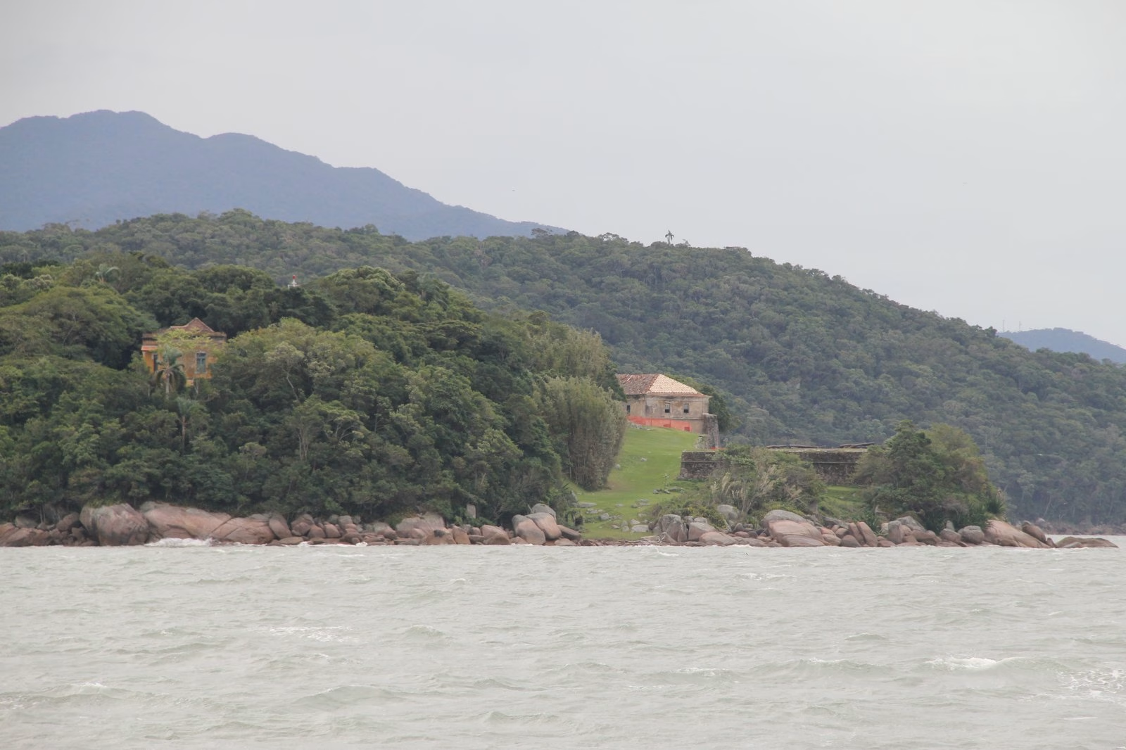
Santo Antônio de Ratones — built on Ilha de Ratones Grande (Ratones Grande Island), in the middle of the channel. It closed the water vertex of the triangle, covering the gap between the other two.
Together, the three crossed fire over any ship that pointed toward the northern mouth. An invader would have to pass beneath three converging lines of fire.
There is a fourth piece of the system, outside the triangle: Nossa Senhora da Conceição de Araçatuba, raised to the south to watch the bay’s other entrance. It never carried the same weight, and today it is not an official tourist site. It can be seen from a boat, but it receives no structured visitation.
The Spanish invasion of 1777: when the system was tested
A defensive system is only measured under attack. The test came in 1777, and the result was not the one expected.
A powerful Spanish expedition, with dozens of vessels and thousands of men under the command of Pedro de Cevallos, appeared off the island. Faced with the imbalance of forces, Portuguese resistance collapsed: the fortresses surrendered without the prolonged battle their architecture promised. Santa Catarina fell under Spanish control.
The occupation was brief. Through diplomacy, under the Treaty of San Ildefonso, signed later that same year, the island returned to Portugal the following year. The military lesson, though, remained: fortifications are worth as much as their garrison and the resolve of whoever commands them, not the stone alone. The walls were standing; what was missing was everything else.
From abandonment to restoration by UFSC
Once their military function had passed, the fortresses fell into decline. Through the 19th century and much of the 20th, they served various uses and suffered from neglect and the wear of time and sea.
Official recognition as heritage came in 1938, when Anhatomirim, São José da Ponta Grossa, Santo Antônio de Ratones, and the Fortaleza de Santana, this last one beside the present-day downtown, were granted protected-heritage status (tombamento, Brazil’s federal heritage listing) by the then SPHAN, today IPHAN, the country’s national historic and artistic heritage institute. Araçatuba would only be listed in 1980.
Heritage listing protects, but it does not restore. The physical rescue came in the decades from the 1970s to the 1990s, when the Universidade Federal de Santa Catarina (UFSC, the Federal University of Santa Catarina) took on the recovery and management of the main fortresses. It was this university work (historical research, architectural restoration, and opening to the public) that gave the fortresses back to the city as visitable spaces. UFSC still leads the administration of much of the set.
How to visit the fortresses today
The geography that made them effective also defines how you reach them.
São José da Ponta Grossa is the accessible exception: it sits on the island itself, in the north, and is the only one of the triangle’s three that can be reached by car. The route runs along the SC-401 highway toward Jurerê, with the fortress just beyond the beach. It is the natural choice for anyone who does not want to depend on a boat.
Santa Cruz de Anhatomirim and Santo Antônio de Ratones stand on islands, and are reached only by water. Schooner tours depart from points such as the Beira-Mar (the downtown seafront avenue) and the north of the island, usually pairing the fortress visit with the dolphin bay. It is a full-day outing, not a quick stop.
Araçatuba, to the south, has no official visitation. At most it can be glimpsed from a boat.
A practical note is worth making: opening hours, ticket prices, and boat operations change by season and by management. Before you go, confirm the current conditions on the site of UFSC’s Fortresses Department (fortalezas.ufsc.br), which is the official source. Bring cash: the ticket office does not always accept cards.
Frequently asked questions
How many fortresses does Florianopolis have?
The 18th-century defensive system brings together four fortresses tied to the bay’s entrance: Santa Cruz de Anhatomirim, São José da Ponta Grossa, and Santo Antônio de Ratones (the northern-mouth triangle), plus Nossa Senhora da Conceição de Araçatuba to the south. There is also the Fortaleza de Santana, beside downtown, likewise heritage-listed in 1938. Of the four in the bay-mouth system, three receive structured visitation.
Which fortress in Florianopolis can you visit by car?
São José da Ponta Grossa, in the north of the island, near Jurerê. It is the only one of the defensive triangle reachable by road, via the SC-401. Anhatomirim and Ratones stand on islands and are reached only by boat.
How do you get to the Anhatomirim Fortress?
Only by sea. Tourist schooners depart from points such as the Beira-Mar Norte, downtown, and from the north of the island, usually on a full-day tour that includes the dolphin bay. Confirm times and departures with the operators and on the UFSC site before planning your day.
Who built the fortresses of Florianopolis?
The system was conceived and begun from the early 1740s under Brigadier José da Silva Paes, the first governor of the captaincy of Santa Catarina and a military engineer, to defend the southern frontier of Portuguese domain against Spain.
Are the fortresses of Florianopolis protected heritage?
Yes. Anhatomirim, São José da Ponta Grossa, Santo Antônio de Ratones, and Santana were heritage-listed in 1938 by what is today IPHAN; Araçatuba, in 1980. The restoration and management of the main fortresses fell to UFSC from the 1970s onward.
Getting to know the island from within
The fortresses tell of a Florianopolis before tourism: a frontier island, conceived as a strategic position long before it was thought of as scenery. Understanding this layer changes the way you look at everything else: the same geography of a sheltered bay that drew cannon in the 18th century is what, centuries later, defined where the city grew.
This historical reading connects to others: the Hercílio Luz Bridge and what it teaches about the city, the path of Florianopolis from isolated island to real estate capital of the South, and the making of neighborhoods of old origin such as Estreito.
At Regente, knowing the island from within is part of the work of curation: those who understand the history of a place choose better where to live in it. If you would like to talk about living in Florianopolis with this kind of perspective, talk to our curation team.
Read also: the history of Florianopolis