If you’re evaluating a property in downtown Florianópolis — especially along Rio Branco Avenue or near the waterfront — there’s a document that needs to be part of your analysis.
In February 2026, the architecture firm Gehl Architects (Copenhagen) delivered the masterplan for urban renewal of downtown Florianópolis. The 136-page document mentions Rio Branco Avenue in direct contexts and treats Beira-Mar Norte as one of three highest-priority pilot projects.
This guide details what’s planned for each of these areas.
1. Rio Branco Avenue in the Gehl Plan
1.1 Street classification: Type M Corridor
The Gehl masterplan classifies downtown streets into five typologies (XL, L, M, S, Cal.) with distinct proposals for each. Rio Branco Avenue and Avenida Gama D’Eça are classified as Type M — secondary collector street.
What’s planned for Type M corridors:
| Intervention | Detail |
|---|---|
| Unidirectional segregated bike lane | On both sides of the street, physically separated from car traffic |
| Priority bus lanes | Preference for public transit in the corridor |
| Minimum 2.5 m sidewalks | Expanded walking area with tree canopy |
| Speed reduction | Integrated into street redesign — not just signage |
The bike lane on Avenida Gama D’Eça is explicitly cited as a best-practices pilot project — the street where the proposal can be implemented first as a model for other Type M corridors.
1.2 Active ground floors on the Esteves Júnior → Rio Branco axis
The document identifies the Rua Esteves Júnior → Rio Branco Avenue axis as a priority for the active ground-floor strategy: commerce, cafés, restaurants, and services on building ground floors — instead of parking garages, walls, and dead façades.
Active ground floor is an urbanism concept that measures whether a building’s street level contributes to street vitality — whether there’s something happening outside that invites pedestrians to enter, stop, and use the space. The opposite — a garage or wall at street level — creates a “dead façade” that empties the sidewalk and reduces safety and appeal for the entire block.
The masterplan proposes transforming the Rio Branco corridor into a zone with active commerce and services at street level, integrated with the bike lane and widened sidewalks.
1.3 Urban drainage
Avenida Gama D’Eça / Rio Branco Avenue is flagged as a priority area for urban drainage solutions — rain gardens and bioswales integrated into sidewalk and bike-lane interventions.
1.4 The epicenter of active mobility transformation
The document defines the zone between Rua Esteves Júnior, Rua Bocaiúva, Rio Branco Avenue, and the waterfront as the epicenter of active mobility transformation in the masterplan. This zone concentrates:
- The Type M corridor (Rio Branco Avenue)
- The School Zone — pilot project on Rua Esteves Júnior Norte
- Access to Beira-Mar Norte crossings
- The priority axis for active ground floors
A property within this zone has a direct geographic relationship with the planned interventions.
2. Beira-Mar Norte in the Gehl Plan
2.1 The current problem: an 11-lane barrier
Avenida Jornalista Rubens de Arruda Ramos — Beira-Mar Norte — is today one of the largest barriers between downtown Florianópolis and the sea. The document records the data:
- 8 to 11 traffic lanes
- Speed of 80 km/h
- Noise level of 76 dB — above the World Health Organization’s 65 dB limit
- Insufficient traffic signal time for pedestrians to cross comfortably
The result is that downtown Florianópolis — an island city with a vocation for connection to the sea — is effectively separated from the waterfront by an urban expressway.
2.2 The pilot project: Safe Crossings on Beira-Mar Norte
The masterplan’s third pilot project proposes reconnecting downtown to the sea through qualified pedestrian crossings. The document analyzed three scenarios:
| Scenario | Assessment |
|---|---|
| Raised and widened crossing | Recommended — more accessible, replicable, viable cost; requires speed reduction on street |
| Street depression (tunnel) | Transformative impact but extremely high cost (references: Rose Kennedy Greenway/Boston US$24 billion, Madrid Río €4 billion) |
| Elevated pedestrian bridge | Not recommended — creates accessibility barriers and loses street-level vitality |
The firm’s recommendation is for the most pragmatic solution: physically qualified pedestrian crossings — raised, widened, well-lit, with adequate signal timing — combined with street speed reduction.
2.3 The waterfront linear park
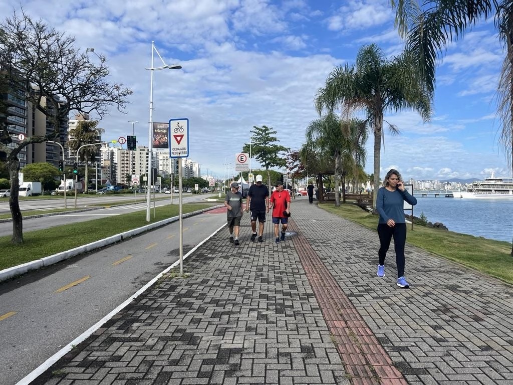
Beyond the crossings, the masterplan proposes a linear park on Beira-Mar Norte, stretching from the Rowing Club to the CIC, with:
- Native tree species (Purple Ipe, Olandi, Aroeira)
- Integrated bike lane
- Sitting and rest areas
- Rain gardens and nature-based drainage solutions
The linear park transforms the waterfront from a fast-transit corridor into a destination — which directly affects property values within its influence radius, exactly as occurred in comparable international cases.
2.4 International precedents for city-water reconnection
The masterplan cites three cities that transformed infrastructure barriers into public spaces:
- Seoul — Cheonggyecheon: stream covered by elevated expressway was recovered in 27 months; 170,000 vehicles redistributed; area transformed into landmark urban linear park
- Madrid Río: 6 km of expressway buried; linear park created on surface; appreciation of all adjacent neighborhoods
- Rio de Janeiro — Orla Conde: demolition of the Elevated Perimetral; 3.5 km linear park; recovery of downtown’s connection to the harbor
In Florianópolis, the proposal is not as radical — it doesn’t involve burying or demolishing Beira-Mar. But the principle is the same: qualifying the city-water relationship increases property values in the surrounding area.
3. What these interventions mean for the local real-estate market
3.1 The highest-impact corridor
The most concentrated interventions are within a 5 to 10 minute walk from properties located between Rio Branco Avenue and the waterfront. This is the corridor where:
- Sidewalk quality will improve (Type M)
- A bike lane will exist (Rio Branco / Gama D’Eça Avenue)
- Sea access will become safer and more pleasant (crossings)
- Street-level commerce tends to increase (active ground floors)
For properties in this corridor, each of these improvements represents a real increase in walkability and neighborhood completeness — the two factors most consistently correlated with property price in urban markets.
3.2 What precedents suggest
In Copenhagen, where Gehl Architects implemented similar interventions (segregated bike lanes, widened sidewalks, qualified public space in specific corridors), properties in intervention areas appreciated 20 to 40% above the rest of the city. The differential is permanent — public space quality doesn’t depreciate.
In Brisbane, Auckland, Porto, Seville, and other cities that invested in reconnecting downtown with the waterfront, the pattern is similar: the band of properties between historic downtown and the water appreciates above average after the crossing or waterfront is qualified.
3.3 Current state: project delivered, works not yet started
As of May 2026, the masterplan exists but construction has not begun. There is no official start date. Implementation depends on budget allocation and political will across multiple administrations.
This means that whoever buys today in the Rio Branco — Beira-Mar corridor is buying before construction starts — the moment that, in documented international cases, generated the highest return. And also with the highest risk: if the project isn’t executed, the investment must be supported by the neighborhood’s current fundamentals.
FAQ
What does the Gehl Plan propose for Rio Branco Avenue in Florianópolis?
The Gehl masterplan (February 2026) classifies Rio Branco Avenue as a Type M corridor — secondary collector street. Proposals include unidirectional segregated bike lane, priority bus lanes, sidewalks with a minimum width of 2.5 m, and redesign for speed reduction. The Rua Esteves Júnior → Rio Branco Avenue axis is also identified as a priority for active ground floors — commerce and services on building ground floors.
What does the Gehl Plan propose for Beira-Mar Norte in Florianópolis?
The masterplan proposes three interventions on Beira-Mar Norte: (1) qualified pedestrian crossings — raised and widened crossing with adequate signal timing — to reconnect downtown to the sea; (2) linear park on the waterfront, from the Rowing Club to the CIC, with native tree species, bike lane, and sitting areas; (3) speed reduction on the street from 80 km/h to 60 km/h. Street depression (tunnel) was analyzed but not recommended due to cost.
What’s the difference between a segregated bike lane and a bike lane?
A segregated bike lane is physically separated from car traffic — by curb, bollards, or elevation difference. A bike lane is paint on asphalt with no physical separation. The Gehl masterplan specifically proposes segregated bike lanes for Type M corridors (including Rio Branco and Gama D’Eça Avenues) — safer and generate higher ridership, especially among women and children (Florianópolis’s PSPL study documented that only 4.4% of cyclists use bicycle, and inadequate infrastructure is cited as the cause).
Is Rio Branco Avenue a priority corridor in the Gehl Plan?
Yes. The document identifies the zone between Rua Esteves Júnior, Rua Bocaiúva, Rio Branco Avenue, and the waterfront as the “epicenter of active mobility transformation” in the masterplan. Rio Branco Avenue appears in four contexts in the document: Type M classification (bike lane + sidewalks), active ground-floor axis, area of focus for urban drainage, and expanded-walkability corridor.
When do the Gehl Plan works start in Florianópolis?
The masterplan was delivered in February 2026 and is a guidelines and pilot-projects document — not an executive project with a defined works start date. Implementation depends on subsequent phases: detailed project design, approvals, public budget, and bidding. There is no official works start date as of May 2026. The document has a 10 to 15 year implementation horizon, with the three pilot projects as short and medium term priorities.