You get to know Florianópolis best on foot. Some beaches exist only for those willing to walk half an hour through the forest, some fishing villages have no road for cars, and lookout points reveal both bays at once. The city has more than thirty mapped trails, and many of the landscapes that appear on postcards sit at the end of one of them.
This guide brings together seven routes that cover the range of people who hike the Island (Florianópolis sits on the Island of Santa Catarina): from a short climb to catch the sunset to a crossing that takes a whole morning. For each one, you’ll find the difficulty level, the distance, the average duration, and what to expect along the way.
The idea isn’t to list every trail in Florianópolis, but to give you an honest starting point for choosing the right one for your fitness and your schedule. At the end, a practical summary of when to go and what to bring.
Before you lace up: what every trail on the Island demands
Florianópolis is an island of hills covered in Mata Atlântica (the Atlantic Forest), and nearly every trail alternates between stretches of deep shade and rocky headlands exposed to sun and wind. That changes the planning: the same route is easy on an autumn morning and exhausting on a January afternoon, since January is high summer in Brazil.
It’s worth understanding three points before any climb. First, the difficulty level given is an average, and the terrain gets harder after recent rain, when rocks and roots turn slippery. Second, several trail-access beaches have no facilities, which means carrying your own water and your own food. Third, some of these routes cross conservation areas, where the rule is to walk only on marked paths and leave no trash behind.
The safety advice that local guides repeat is simple: start early, tell someone your route and your expected return time, and avoid remote trails on your own. On busy routes this matters less; on the more deserted ones, it makes a difference.
Lagoinha do Leste: the signature trail of the south
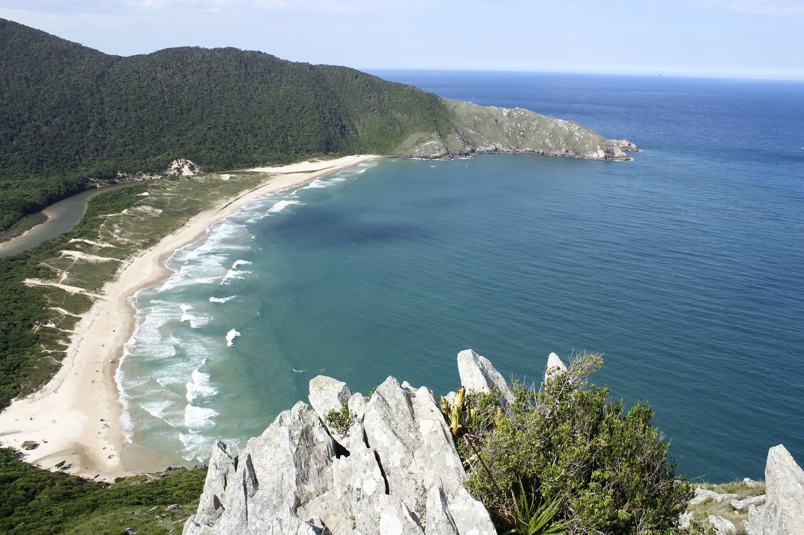
If any single trail represents Florianópolis, it’s this one. Lagoinha do Leste is a beach with no car access, framed by hills, in the south of the Island. You reach it by two paths with very different profiles.
The access from Pântano do Sul is shorter, about 2.2 km, but it demands a steep climb right at the start and takes around an hour one way. The access from Praia do Matadeiro is longer, close to 4 km, with sun-exposed stretches along the headland, and calls for 2.5 to 3 hours. Counting the walk out, back, and stops, the hike commonly takes 5 to 7 hours in total.
Those with the stamina often add the climb up Morro da Coroa, an extra steep stretch of 20 to 40 minutes that opens up the view over the beach and the open sea. It’s the most demanding version of the outing. The overall level ranges from moderate to hard, depending on the combination of routes. There are no shops on the beach, so water and food go in the backpack.
Costa da Lagoa: the village you can only reach on foot or by boat
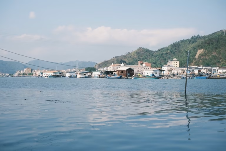
Costa da Lagoa is an old fishing settlement on the shore of Lagoa da Conceição (a large coastal lagoon), with no road for cars. You arrive on foot along the trail or by boat, and that’s exactly the charm of the place.
The route follows the lagoon along a wide path with gentle terrain, which makes it accessible for most fitness levels. Sources vary between 5 and 7 km to the center of the community, with a duration of 2 to 3 hours of easy walking. Along the way there are waterfalls to swim in and, at the destination, seafood restaurants well known across the Island.
One detail makes the outing comfortable: you can walk out and return by boat. The boats run like a regular line over the water, with stops along the lagoon. It’s the choice for anyone who wants the trail experience without repeating the effort on the way back.
Naufragados: the lighthouse at the far south
Naufragados sits at the southern tip of the Island of Santa Catarina, about 35 km from downtown Florianópolis. You leave the car at Caieira da Barra do Sul and follow a trail of roughly 3 km to the beach, around 50 minutes to an hour of walking.
The level is considered easy, with one caveat: the start has a steep, rocky stretch. Once that part is behind you, the path is wide, well marked, and fairly flat. On the headland, a lighthouse opened in 1861 guards the entrance to the southern channel. At low tide, you can get close to it.
The name carries history. Naufragados means “the shipwrecked.” Accounts attribute the place name to the shipwrecks recorded in the region between the 18th and 19th centuries. One of the most cited versions points to 1753, when ships carrying Azorean colonists south are said to have wrecked here, with many lives lost. There is also mention of a shipwreck linked to the expedition of Juan Díaz de Solís in 1516. These are historical narratives documented differently across sources, and they are best treated as such.
Morro da Cruz: the 360° view over Florianópolis
Not every trail on the Island is far from the pavement. Morro da Cruz rises over the central massif, and from the lookout at the top, at 285 meters, you can see the North and South bays, downtown, and the bridges in a full 360-degree turn. From up there, you can grasp the geography of Florianópolis all at once.
The site is part of the Parque Natural Municipal do Morro da Cruz (a municipal nature park in Florianópolis), with signposted trails and free access. You can go up by car or bus along Avenida do Antão, which is the most practical way, especially at dusk. On foot, the climb is moderate and calls for some fitness given the incline, taking about 1 to 1.5 hours.
Because it crosses an urban area, the climb on foot calls for extra care, and many visitors prefer the car or public transport to the top. It’s the trail on this list that’s easiest to fit into an ordinary late afternoon, without leaving the city.
Gravatá: the hidden beach off Barra da Lagoa
Between Barra da Lagoa and Praia Mole there’s a small cove reached only by trail or by sea: Gravatá. The access on foot is short and part of the routes made official by the city, known as the Caminho dos Pescadores (the Fishermen’s Path).
Starting from the end of Avenida das Rendeiras, the round trip adds up to about 5 km and can be done in a little over half an hour of actual walking. The level is light, suitable for beginners, with one note: the start is mostly uphill, and that’s where the trail asks for some breath.
It’s a good entry point for anyone just starting out who wants the reward of an almost deserted beach without facing hours of walking. The lack of car access is what keeps the place quiet.
Praia do Saquinho: the cove beyond Solidão
In the south of the Island, past Praia da Solidão, the road ends and the trail to Saquinho begins. It’s a short route, between 1.3 and 1.8 km depending on the source, done in something like 30 to 60 minutes.
Much of the path is paved with concrete slabs, which makes the going easier even for families. Even so, there are short climbs that take some breath, especially in the heat. The level sits between easy and moderate. As with other trail-access beaches, there are no facilities at the destination, so water, sunscreen, and a snack are essential.
Saquinho rewards you with a secluded beach and greenish water, in one of the quietest spots in the south of the Island. You leave the car in the parking areas at Solidão.
Costão do Santinho: walking over four thousand years
In the north of the Island, the Morro das Aranhas trail, next to Costão do Santinho, brings together landscape and archaeology. On the rocks of the headland are petroglyphs, carvings of circles and geometric shapes attributed to pre-colonial peoples associated with the region’s sambaqui builders (ancient shell-mound communities).
The academic estimate is that the carvings are between one thousand and four thousand years old. It’s worth noting that dating and authorship are researchers’ interpretations, not settled certainties. The site is an archaeological one, heritage to be respected and observed without contact, not just any curiosity.
The Morro das Aranhas trail is medium to high in difficulty, with a duration of about 1.5 hours, and gives access to lookout points and the rock-art panels. Some of the carvings sit on land next to the area’s resort, so it’s worth confirming the access rules before you go. It’s the route on this list that most blends physical effort with a reading of the Island’s history.
When to go and what to bring
The best window for hiking trails in Florianópolis runs from May to November, the period of less rain. March, April, and early May combine good weather, pleasant sea temperatures, and fewer people on the routes. In summer (December to February in Brazil), the heat and sudden downpours make the trails harder and more slippery.
Whatever the trail, a few items belong in every backpack:
- Footwear with good grip: sturdy sneakers or lightweight hiking boots.
- Plenty of water, at least 1.5 liters per person on the longer routes.
- Sunscreen, a hat or cap, and sunglasses.
- Insect repellent, a light snack, and a small first-aid kit.
Start early to avoid the strong afternoon sun, tell someone your route, and prefer to walk with company on the quieter trails. Respecting the forest, the wildlife, and the marked paths is part of keeping these places open.
Frequently asked questions
What is the easiest trail in Florianópolis for a first-timer?
For beginners, three routes in this guide are the most accessible: Gravatá, short and light despite the initial climb; Costa da Lagoa, with gentle terrain and a return by boat; and Naufragados, easy once the rocky opening stretch is behind you. All require basic fitness, proper footwear, and water.
Which is the hardest trail on this list?
Lagoinha do Leste via Praia do Matadeiro, especially if you add the climb up Morro da Coroa, is the most demanding. The full route can run past 5 hours, with sun-exposed stretches and steep climbs. The Morro das Aranhas trail, at Costão do Santinho, is also rated medium to high.
Do you need a guide to hike in Florianópolis?
It isn’t required on the busier, well-marked routes, such as Costa da Lagoa, Gravatá, and Naufragados. On longer, more isolated trails or ones with forks, like Lagoinha do Leste, a local guide adds safety and helps you avoid taking a wrong turn. The general recommendation is not to walk alone on deserted routes.
Can you take children on the Island’s trails?
Yes, on the short trails with gentle terrain. Saquinho, largely paved with slabs, and Costa da Lagoa, flat and with the option to return by boat, tend to work well with children. Trails with long climbs and exposed headlands, like Lagoinha do Leste, call for more fitness and aren’t the best choice for little ones.
What is the best time of year for hiking trails in Florianópolis?
The period from May to November has the most dry days and is the most recommended. Autumn (March to May in the Southern Hemisphere) combines good weather, still-pleasant sea temperatures, and fewer people on the routes. Whatever the season, start early and avoid the strong midafternoon sun.
Getting to know the Island from within
The trails reveal a Florianópolis the road never shows: car-free beaches, fishing villages, carvings thousands of years old, and lookout points that explain the city in a single view. Walking them is, in a way, understanding why so many people decide to live here.
That same curatorial eye guides our work with real estate. Those who want to live close to this nature often look for neighborhoods that balance city and green, a subject we cover in our guide to the best neighborhoods to live in Florianópolis and in an honest look at living in Florianópolis.
If you’re thinking about getting to know the Island from within, and not just passing through, Regente can help you find the right address for your pace. Talk to our curators when you’re ready to take that step.
See also: the history of Florianópolis